Tuesday, August 7, 2012

Hike to Tanner Mountain - Josephine County, Oregon

08/08/2012 - Author's note --  History has proven to be wrong on the name of this mountain and the lakes that lie beneath it.  The correct name is "Tanner," and future maps hopefully will correct this misspelling so long in err.

Thanks to Gary Swanson for the following post...

Beginning our trip from Grants Pass, Oregon, we headed Southwest on Highway 199, which is called the Redwood Highway, as it will take you to the majestic redwood forests in California.  At Cave Junction, we headed toward California Via Waldo Road, which becomes Happy Camp Road.  Just after entering California, we turned left into the Siskiyou National Forest, and after meandering back and forth over the state lines, we finally reached our jumping-off point in Oregon, and Josephine County. We were fortunate this time of year to drive far in without 4 wheel drive. We began our hike in the Red Buttes Wilderness area.
The trail winds uphill, through thick forests that thin out gradually as we climb.
The silence is incredible!
There are no sounds, other than our footsteps, and my labored breathing.
No birds were present at this altitude, as there really isn't anything for them to eat.
Talk about the "forest primeval", when a tree dies, it may still remain standing for another fifty-plus years. Protected by its neighbors, it could stand guard for a hundred years, unless fire should expose it to the winds by clearing away its' defenders.


There is an occasional sound of a chipmunk scurrying away from our approach, but you can hear your heartbeat up here. Not a plane, or vehicle!
This bear sign was exciting to find, as we saw places that had been ravaged, likely so it could dig up a squirrel, or some ants for lunch.   Desperation for adventure must have taken over for me to resort to photos of scat!
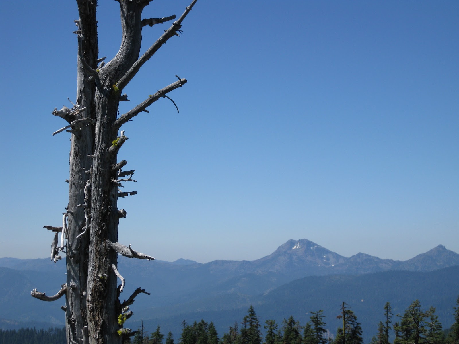
From alongside the trail, the terrain beyond is wild, and beautiful!
Underbrush is not difficult to bypass, as it grows slow this high up.
The bears sometimes hasten the decay of the rotting trees. This one was likely here long before Christopher Columbus was even born.

Do I see an end to this trail?
Looking back, at my wife following behind with our other dog, as I break trail to fend off the creatures of the mountain, and listen for the cry of the Sasquatch.
Wow! Just as I thought we had made it to the top, I cross the beautiful meadow, and as I peer over the edge, I see More mountain!  A LOT MORE Mountain!
This is not the peak, so we trudge across, and up the meadow.
This is a view into the "roadless" wilderness.
As we reach the upper end of the steep meadow, the actual peak is challenging my 70 years, and I wonder if I am even capable of making such a climb.  After a lifetime of wearing a tie, and dress clothes, where the highest climb I had to make was up the "corporate ladder", this seemed a bit much.  Also being as I hate heights, what a challenge!


Beginning the assault on the summit, and my better sense, the views became even more incredulous for a city boy.
Looking back down was easier.
The trail winds along the edge in places to avoid the ancient, twisty, and very thick mountain shrubs.
Now we can see another mountain range in the other direction.
Now, we are close to the sheer face of the summit, and it makes me wonder how the "real" mountain climbers ever get the nerve the first time the one of these things going straight up the cliff!
Only one time-ravaged tree remains.  There are no signs of others, and it sits as a silent sentinel about halfway up to the peak.  If only we could observe what it has seen.  When you consider how long it took to grow at over six thousand feet this is really astounding.
Made it!  Here we are, dogs, and all!  The only thing miserable about the entire trip was the thousands of BLACKFLIES!

I have heard about them, but in 3 and a half years in the area this was my first encounter.  There were literally well over a thousand of the innocuous, vile creatures.  They covered the entire peak, and my immediate thought was that we may find something dead, but a quick look around revealed nothing.  I did not get the feeling of being bitten, as I have had several thousand mosquitoes on me in a Minnesota swamp before, but they were so thick that they just covered us completely!  Just a few feet from the top, and the flies returned to their homes; the invaders retreating.
How interesting would it have been to be on the U.S.Geological Survey team? Wherever we go, it seems that these folks were already there.  Looking  We are at 6298 feet above sea level.  I think a trip to the coast will be necessary for me to decompress!
Below us is Tanner Lake.  We have hiked in to this lake, and its little sister East Tanner lake before, and the trail to the lakes also will wind up to where we now stand, but it becomes a total hike of about seven and a half miles which at that time was too much of a challenge for the old guy to care for!

I must confess that my wife took this photo, as I felt mine may have been blurred (which it turned out to be), and I hate heights so much that she got this photo!
You can barely see East Tanner lake in the photo center, but I took it quickly, as the only thing I hate more than looking up, is looking down!
This is from the other side of the peak.
Looking back up at the summit was so much easier, and I realized it was not so bad after I got used to it.  Next, I think of Grayback Mountain: it's over 7000 feet.
A glance back at the sentry tree, and we depart.
Do I see a way up the face?  Forgedaboudit!
Wow, More scat. This time from an elk.
And a Coyote!  I found what I'm certain was a cougar track, but it wouldn't photo.
Also footprints!  Isn't it great that we could bring you all of these signs, and scat?  Anyone can photograph animals, but whoever gets these kinds of mementos?

I know, my wife thinks it's dumb also!
Signs of coyotes are everywhere, as the attempt to dig out the ground dwelling chipmunks.
Now that the peak is over the hill it looks a lot more tame.
The trail back down.
The Tanner Mountain summit is far up and to the right.
Looking Northeast.
One of the lesser peaks on our way out.  The view below is the edge of the cliff-side road, and looking into California.

Thanks for viewing, and WELCOME TO OREGON!

Thursday, August 2, 2012

Wild Bill Hickok - Did General Custer Miss Him?

The following post was written by Gary Swanson.
 

When George Armstrong Custer died at the Little Big Horn, our country lost one of its greatest heroes.

 Just over a month later, James Butler (Wild Bill) Hickok was murdered in Deadwood, South Dakota.

He was shot in the back by Jack McCall, and the poker cards he held would forever be known as the "Deadman's Hand."  His fingers held two black aces, two black eights, and history still argues about the fifth card.

 "Wild Bill" Hickok lies in the Mt. Moriah Cemetery overlooking the town of Deadwood.

On his gravestone it is engraved:
"J.B. HICKOK
DIED Aug 2, 1876
AGED 39 years
CUSTER
WAS LONELY
WITHOUT HIM"

Mt. Moriah Cemetery is authorized by the United States Congress to fly the American flag in perpetuity.  Our country's flag is never lowered here, 

and it watches over the peaceful graves of our western history players.

Monday, July 30, 2012

Middle Fork Trail on the Applegate River

This hike is just a bit south of Josephine County, but in the early days, no one knew if they were in California, or Oregon anyway. When the California tax assessors came around the miners swore they were in Oregon, and the Oregon assessors were welcomed by " California" miners. Today, we took one of the trails on our National Register.

Our trail wound alongside one of the Applegate branches, and we followed it deep into the wild country on the Middle Fork.  Although the sun was hot, it seemed as though this inner world of "old growth" forest controlled it's own temperature. A constant breeze accompanied us as our trail went from the side of the gorge, to drop down to the very water's edge. At times we were along the edge of fabulous pools, and lagoons that were so breathtaking, it was hard to believe this much wild country can exist.

We have been in some of our United States where areas such as this would be State Parks, but Oregon is so rich in abundant beauty that we take such beauty for granted.

Having lived in Minnesota, and Wisconsin, I became suddenly aware that there was something drastically wrong!  My alarm bells were screaming "Danger!" Then I realized what was wrong-- We were sitting on this massive rock with NO MOSQUITOES!  In Minnesota, the evil critters would have gnawed down trees to get at us! 

If you have never had the chance to walk alongside a waterway with only an occasional butterfly for a companion, then welcome home!

The clear, cold mountain waters flow rapidly, as if they know that the Pacific Ocean is still a hundred miles away before they can rest.

Nature rules out here. We chose to go under this one, as a slip climbing over the top would have meant a rough slide down to the top of this tree lying about seventy feet down the cliff.

Everywhere, it was apparent that nature only tolerates our presence, and you wonder how our early miners could possibly have dug in these boulder-strewn streams to get down to "bedrock" where the finer gold was waiting.  Trees reach so high that you can't begin to see the tops.


This "Green Pool" is well documented in historical journals, and many hikers have used it for a point of reckoning.   Deep, clear, and cold.


I could not restst just trying a variety of shots--Amateurs do this.


The small fish came out in the sun, but the big guys stayed about ten feet down in the darkened areas.


Another log but easier this time.


The fun thing about this hike is that there was not another human anywhere.

They say that Sasquatch lives in this area, but I'm sure they heard us coming for miles!

We hiked an extra couple of miles  to see if we could find the end but at this point, the only option would have been to cross the stream, as the trail appeared to continue on the other side.

This was a mining claim, and it is okay to cross it but no gold hunting is allowed.
Instead of continuing, and then having to walk all those miles back with wet boots, we chose to go back and take a short detour back down the mountain.

We found what we were looking for at our detour:  You can see the concrete footing on the other side at the waters edge; at one time this was support for a single log bridge that spanned this crossing.  The log was eighty feet long!

From the bridge location, the water plunges down a steep gully to a pond waiting below. The footbridge led to a mining cabin on the other side. Everywhere along the water you will find signs posted about everywhere you go, someone claims the mining rights, so enjoy, just don't plan to pick up any souvenirs.


With such a beautiful, and scenic trail, we end it here, and make our way back to the point of embarkation.


Thanks to Gary Swanson for providing this post!